Cambodia: A (Very) Few Basic Facts
Geography:
Total Area: Approx. 69,900 sq. miles (181,035 sq. km.). This is
slightly smaller than the state of Oklahoma.
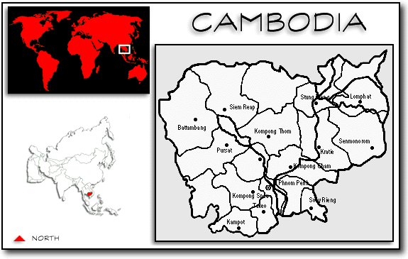
Location: Southeast Asia; bordered by Thailand, Laos, Vietnam, and
the Gulf of Thailand.
Capital: Phnom Penh
Largest Cities: Phnom Penh, Siem Reap, Battambang, Sihanoukville, Serei Saophoan (Sisophon)
Largest Lake: Tonle Sap
Major Waterway: Mekong River
Mountain Ranges: Cardamom, Dangrek
Highest Point: Phnom Aoral, 5,948 feet
Climate: Tropical, with two seasons, Rainy (May through October) and
Dry (October through May). Temperature rarely falls below 27 degrees Celsius(80 degrees
F).
Land and Land Usage: Mostly low, flat plains, with some small mountains
in the north and southwest. About three-fourths tropical forest; roughly one-fifth
arable land. Bulk of remaining land is composed of sandy and infertile soil.
Wildlife: Animals found in Cambodia include monkeys, water buffalo,
tigers, elephants, leopards, and crocodiles.
For additional information, refer to Encyclopedia Britannica: Cambodia
The map on this page were adapted from Graphic Maps.